🌟 Adventure Awaits: Stay connected, no matter where you roam!
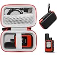
The Garmin 010-01879-00 InReach Mini is a lightweight and compact satellite communicator designed for outdoor enthusiasts. It enables 2-way text messaging through the global Iridium network and features an interactive SOS function for emergencies. With Bluetooth connectivity, users can access downloadable maps and weather updates via the Garmin Earthmate app, ensuring they are always informed and connected during their adventures.


| Display Type | sunlight-readable, monochrome, transflective memory-in-pixel (MIP) |
| Human-Interface Input | Buttons |
| Compatible Devices | Smartphone |
| Control Method | Voice |
| Are Batteries Included | Yes |
| Sport Type | Outdoor Lifestyle |
| Audio Output Mode | Mono |
| Battery Average Life | 90 Hours |
| Resolution | 128 x 128 |
| Screen Size | 1.27 Inches |
| Additional Features | Bluetooth |
| Connectivity Technology | BLUETOOTH, ANT+ |
| Map Types | Satellite |
| Item Weight | 3.52 ounces |
| Item Dimensions L x W x H | 2"L x 1.03"W x 4"H |
C**R
Great Functions, Fairly Easy Use, Compact Package
A friend and I did a recent backpacking trip in a remote part of Alaska. We were never going to be within 100 miles of a road, and our primary recovery by float-plane would be dependent on our proximity to a sizeable lake. We wanted to keep our families informed of our status, we wanted the DarkSky weather reports, we wanted comms with our pilots, and we thought the InReach SOS service was a nice back-up in case things truly got ugly.Here are the functions we used:1. Pre-set text messages to family.2. Weather reports.3. Send/receive text messages to communicate with our pilots on extraction day.Here's how it worked:1. If you log in to your Garmin portal and set up the pre-set messages ahead of time, these are incredibly easy to use in the field. When we configured our pre-sets, we opted to include a link to our location page.We created two pre-sets: one was a simple check-in -- we're OK and here's where we are; the other was an end-of-day, here's where we're camping message. Our family members reported that the texts were reassuring and gave a good point marked on a map, allowing them to keep track of our whereabouts and progress. From our position in western Alaska, it never seemed to take more than 3 minutes for one of the messages to transmit.2. We downloaded a few standard weather reports during our trip to help plan our movement, campsite selection, and rain-fly decisions. The weather reports also helped us coordinate with the pilots for pick-up. These are simple to download, meaningfully detailed, and easy to read on the device. However, I wish each report contained an indication of where it originated from. Quite obviously our reports didn't come from the middle of the wilderness, so which NOAA station created it?3. To communicate with the pilots on our extraction date, I paired the InReach with my phone to simplify the text entry. The Garmin mobile app makes this pretty easy. This gave us near real-time communication with the crew as they were planning to come pick us up. They were able to ask questions about local wind and wave conditions, and we were able to respond with that information and our lat/lon. No complaints about this feature at all. (You can perform this function without linking to a phone, but be prepared to enter characters slowly, worse than texting in 2004.)We did not use the tracking feature while in Alaska, but I did test tracking while wandering on some trails at home, and this works well. If you send friends/family a link to your Garmin page, they can keep near real-time track of where you're at. (Note the potential costs associated with tracking.)I also did not use the InReach as my primary GPS device, because I already have another Garmin GPS that I'm comfortable with. (Consider buying the larger InReach device if you're also in the market for a GPS for navigation. I think the InReach mini will work, but will be less handy.)Battery Life: We were in the backcountry for 7 days. We only turned the device on when we needed it. We used it 3 to 4 times per day, an average "session" being 10 minutes, but our maximum "session" lasted about an hour. The battery never got below 90%. So if this type of use describes your intended use, you could easily spend a few weeks in the bush on a single charge with room to spare for an SOS situation. If you turn on tracking, use the device for continuous navigation, or forget to turn it off, well, you know, plan to burn through the battery faster.Overall, I think the InReach mini is a handy little device that can help with several logistics tasks on true backcountry adventures. It's also a pocket-sized risk mitigation plan in case of injuries, illnesses, etc. I wish the subscription plans were a little more flexible for the occasional wilderness trip. But I simply decided to buy one plan down from what my theoretical sweet spot was, and our entire adventure in Alaska cost me maybe $0.20 in overages. Decent value.Note: If you are at all intimidated by using this device, know that Garmin offers occasional online seminars, and they publish recordings of the previous ones. It's easy to get assistance from Garmin for new users. Also, there are tons of good YouTube videos on these devices. So don't avoid purchasing one simply due to a little tech anxiety. I think it's a pretty simple device to use, and support exists.
P**H
Athlete Tracking
My favorite tracking company closed shop and I needed a tracking solution for my next event. The in-Reach mini works great even if I am using off label. I say that because the inReach is mostly marketed to outdoor adventurists and not endurance athletes.My cycling takes me way out on rural roads with limited cell-signal and best of all limited car traffic. My running also keeps me out of the house for several hours. The inReach lets people follow my progress and keep track of my location.The inReach also works great to track your athlete during an event. Whether a marathon, ultra, or long distance triathlon. You'll know where the athlete is. During a long event that means you can plan your cheer-squad logistics and know the approximate ETA of your athlete. Man, athletes LOVE cheer squads, nothing boosts the energy more than your friends and family cheering.Some of the nitty gritty. You can program 3 Custom Preset messages, which you can send for free. So I use all 3 during training. Here are mine... One says I am ok. The second says I am delayed but still going, just incase people get worried that my position hasn't moved. That's incase I find a good coffee shop or stopped for an extended amount of time I hadn't briefed. The third says things went bad and I need a ride home. Every message you send includes your location coordinates, you know, incase you do need a ride home.You can also send regular text messages. Typing them via the device, well, lets say it makes T9 texting look futuristic. Yup, there's no "quick" texting with the inReach. It's a lot of button pushing, not complicated but lots of pushing and time consuming. The good news is you can program a TON of Quick Text messages... ie store prewritten massages you anticipate you'll use. You can also pair your phone and use the phone as a keyboard. The message goes from phone to your inReach via bluetooth, then the inReach sends it vis Satellite. Your phone does NOT need to have signal.As for tracking, you get to pick how much to share and even set a password on your tracking page. I usually make the password my bib number so my friends and family can track me and it's easy to remember. The tracking updates about every 10 minutes. That works great for long events. In a marathon, that's an update of about every 1 or 2 miles. Cycling about every 3 miles.Other uses, I found myself using it on a road trip. Lets family keep tabs on my progress just in case. It's also nice having SAT Comm capability and not be dependent on unknown cell signal availability or quality.Data plans are reasonably priced... keep in mind you are paying for WORLD WIDE coverage using Satellite Communications.Initial device setup took a few minutes. The unit needs to acquire signal from a Com Satellite (not the GPS sats). Then the setup is akeen to setting up cell service.The earthmate companion app isn't required. However it's a powerful mapping tool that's definitely worth getting. You get access to topos, and all sorts of maps. I use the app a ton just looking for trails and training routes. To clarify the earthmate app is for the eathmate user. Those tracking you don't use earthmate.The in-reach website is fairly easy to use. Play around with it for a bit, it takes a little getting used to but it works well and lets you adjust all sorts of stuff. Your tracking, privacy, etc. You can also set up auto tracking posts via twitter.Keep in mind that the inReach uses Satellite coms. So it takes anywhere from a few minutes up to 10 minutes for your data, tracking or text, to transmit into space, and the Satellite to pick it up, transmit it back to earth, send it via terrestrial networks to it's destination.... same for the return back... That's potentially up to 20 minutes roundtrip from send to reply. Quite sci-fi isn't it?I bought the inReach to use off label as an athlete tracker for long distance events and it has worked great for that purpose. Now, i find myself using the inReach way more that I thought I would. Road trips, mountain biking, hiking, wildlife spotting. Pretty much take it everytime I leave the house for non-routine trips. I've used it to text with family. This is perhaps the best and most versatile item i purchased in 2019.One last note, as with most advanced pieces of technology, you'll get out of it what you put into it. Take your time and learn the device, it's interface, it's website... the more you learn it the better your experience will be. This applies to smart watches, computers, and pretty much any tech. Like I said this is the best thing i purchased in 2019.
ترست بايلوت
منذ شهر
منذ 5 أيام