🌐 Elevate your space—touch the world, own the moment.
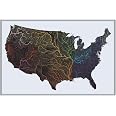
The Hubbard Scientific 3D World Ranger Map is a 36'' x 24'' raised relief map that combines expert cartography with hand-vacuum-formed molding to create a tactile, visually stunning representation of global terrain. Printed on high-grade rigid vinyl with satellite-based natural colors, this map offers an educational and artistic experience, proudly crafted in the USA by a family-run company with over 30 years of expertise.


| Manufacturer | Hubbard Scientific |
| Brand | Hubbard Scientific |
| Item Weight | 8.8 ounces |
| Product Dimensions | 36 x 24 x 0.1 inches |
| Color | Multicolored |
| Size | 36'' x 24'' |
| Sheet Size | 24 inches x 36 inches |
| Paper Finish | Matte |
| Manufacturer Part Number | RR-WORLD-RANGER-unframed |
H**
Excellent map!
This map is beautifully made and very high quality.
K**A
Wonderful map!
A family member was trying to understand the location of Egypt — other maps had so much information, including color coding to help one see national boundaries, that it was hard to get oriented. This map shows country boundaries, but the information is primarily about the earth itself — the topography, vegetation, and waters. As a result, one instantly, viscerally, gets a sense of the relations of things — of how dramatic the Himalayas are, and the mountainous west coast of South America. Right away we could see Egypt’s relationship to Africa, the Mediterranean and Europe. It takes more than one kind of map to see an area, but this is an excellent map for starting with the big picture. It’s well-made, too. Just love it!
W**E
Relief elevation exaggerted too much to use in a secondary classroom.
I ordered the map for my high school science classroom. It arrived with a small split at a corner - not a huge problem but for the money it should be unblemished - and the print was off from the relief by about 1/4 inch, so there is a distortion between where submerged and non-submerged landforms are. But the biggest problem by far is that the scale of the relief elevations is exaggerated too much to be useful in a classroom. For example, if you apply the distance scale to elevation, the Himalayas rise about 500 miles above sea level. It could be there was an error made with the manufacture of just this one map and also the description did not state explicitly that the elevation is to scale, so I was taking a chance. This could absolutely be useful in a classroom setting for younger students to give a general idea of landforms, but not for secondary level.
I**1
Fabulous map for 8 year old
The map is lightweight and has excellent detail. Our grandson is into geography and he loves the map. We were even able to use the map to discuss how the continents moved apart because there is good detail.The product arrived ahead of schedule, well in time for Christmas.
Y**A
3D Map of the world
I’m going to start by saying that is way too expensive for the quality and it also needs to be in a better package, so it I’m going to start by saying that is way too expensive for the quality and it also needs to be in a better package, so it doesn’t ben. I think it should be more like $ 50 or less. I’m going to keep it since I got it for my son’s birthday.
P**.
Great map…
Great map…
D**.
Expensive price for what was delivered
Although the map is in good condition, and the edges appear to be like a frame, it’s kind of cheap looking for the almost $100 price I paid. I’m going to keep it and put it up in my classroom, but I think the price is high for what was delivered. Kind of disappointed.
O**G
So Informative and Eye-Opening!
This relief map clearly shows the terrain across the world. This changes the perspective of the mountain range sizes and lengths, especially those with presumptions of how our land lays !
Trustpilot
1 week ago
1 month ago