
Desert Online General Trading LLC
Dubai, United Arab Emirates
Desert Online General Trading LLC
Dubai, United Arab Emirates


Elevate Your Mapping Game! 🚀
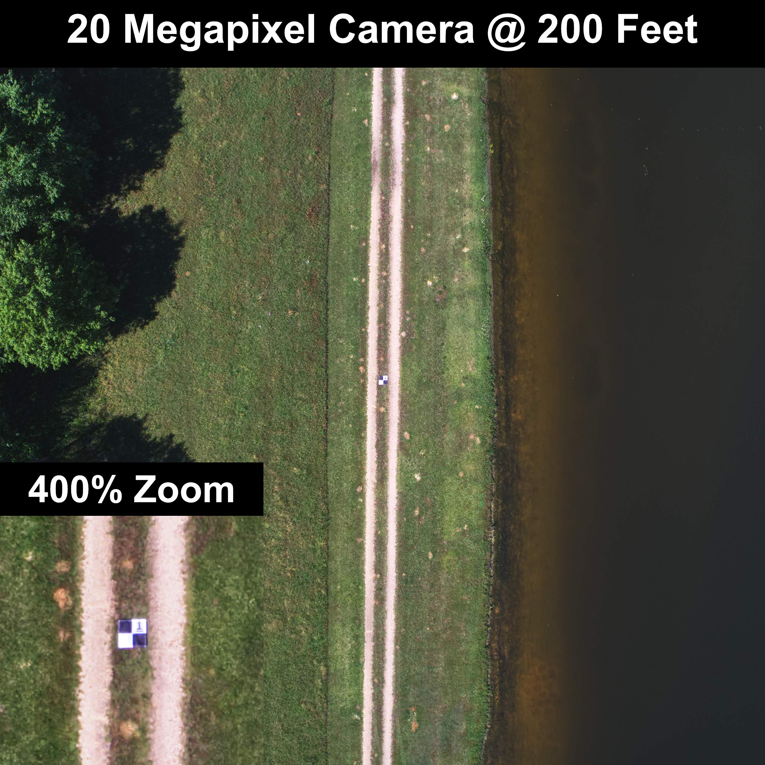
The Sky High Bull's-Eye Drone Ground Control Point (GCP) is a 10-pack of 24"x24" aerial targets designed for low to medium altitude drone mapping and surveying. Made from weatherproof mesh material, these GCPs are lightweight, durable, and easily identifiable from up to 400 feet. Each target features a center eyelet for efficient setup and corner anchor points for stability. Compatible with leading photogrammetry software, these GCPs are an economical choice for professionals in surveying, construction, and education.
Trustpilot
2 weeks ago
2 months ago
2 months ago
1 month ago